News to the flosm thematic maps
15/01/2024
New features for the power grid map
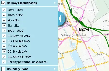
Due to the great interest in the power grid map, we revised its content at the turn of the year. We created new switchable layers specifically for the rail power grid and evaluated and added some additional tags. We have also visualized underground cable routes (dashed) and revised the DC layer. A complete list of all evaluated key/value pairs and combinations can be found here.
If you have any additions, requests or criticism, please send an e-mail to info@123map.de.
05/10/2023
WMS service for flosm theme maps
As of now we provide all maps available here or individual styles and contents as WMS service. The layers can be configured analogous to the switching elements in flosm with any single or collective layers. We can also configure the service individually for you.
For example, QGIS or ArcGIS are well suited for use.
If you are interested, please contact us at info@123map.de.
01/24/2018
New website for printmaps
At www.map-machine.com you will find a great tool for creating your own map themes with configurable pen styles, colors and content from OpenStreetMap and NaturalEarth.
Likewise, GPX tracks can be simply dragged and dropped into the map. The maps can be exported as vector files with layers for prepress. Later post-processing with Adobe Illustrator®, Affinity Designer® or CorelDRAW® is easily possible.
Later we will include a link in the flosm maps that will allow an export for the thematic maps.
08/24/2016
New bike map published
You can get a quick overview of the subject bicycle in our bicycle map.
Under "routes" you find switchable cycle routes and logged bike trail signage for local, regional, national and international routes.
The menu item "service" enables the switching of bicycle repair shops, rental stations, shelters etc. while the following menu item "environment" allows the turn on of beer gardens, cafes, swimming opportunities and more.
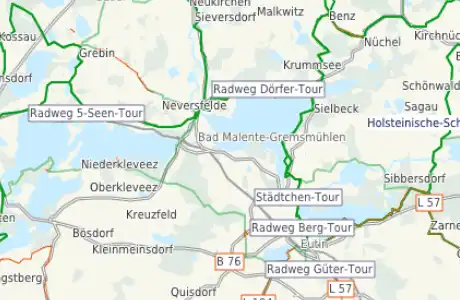
The "bike trails" allow the presentation of the captured cycle network in the map. There is a distinction between driving opportunities on sidewalks, on streets and in bus lanes. The separate roads cycle paths and bicycles paths only can be watched there. For the guys with local knowledge problems with the OSM data can fast be found and changed in Josm by a right mouse click on the map.
Since the data is completely updated weekly, these changes can be found after a few days in our maps.
Friends of mountain biking can display logged mountain bike trails. As far as recorded different levels of difficulty of the routes are highlighted in color and by dashed lines.
By the way...
The on the right menu switchable information can be combined according to personal preferences. A change to another thematic map in its current detail allows for example the inspection whether a Bus or train station is close.
05/18/2016
Map for water sports online
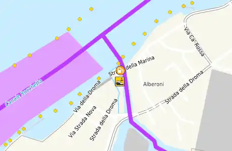
The new theme map water shall facilitate the preparation and planning of tours with paddle boats, motor boats and offshore boats.
Therefore we have prepared a number of layers from the OSM data. For the non-motorized boats the map provides an overview of all useful routes for this category (shown with a green and blue line). In the category whitewater difficulty levels are displayed in different colored and dashed lines. More assignable parameters as sluices, weirs, put-ins and put outs, portages, obstacles in the water etc. are switchable from the right menu.
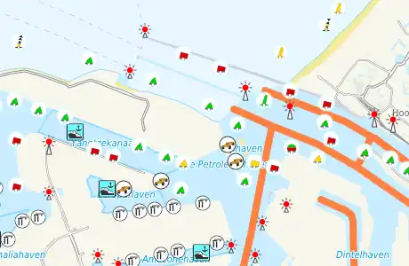
For motorized boats in OSM accordingly attributed routes are shown as thicker, blue-magenta line. Allowed lakes or fairways for motorboats are represented as surface in a slightly lighter shade. Also in this area it is possible to add important POIs via the sitches menu. These includes slipways, piers, anchorages, moorings, buoys etc.
For oceangoing boats, further POIs can be switched and the navigable routes (CEMT classes) can switched too as a uniform, thick orange line and the appropriately labeled areas in a light orange.
The boat-less water enthusiasts can dicover swimming and beach resorts the map. Also jet skis, water skiing, rowing, sailing, surfing and consorts can be switched on as POI information.
Overview for itinerary
All switchable routes, areas and POIs have in common that they are visible from "far" in the map. This simplifies planning and you'll find important stations quickly. From there it goes via zoom further into the map details.
But not only the water sports enthusiasts will find information so fast and clear. Also, the Mapper can see at a glance where watercourses and details are not yet marked. A click with the right mouse button opens a context menu, which allows editing of the current section in JOSM.
04/12/2016
Switching to HTML5 for mobile devices
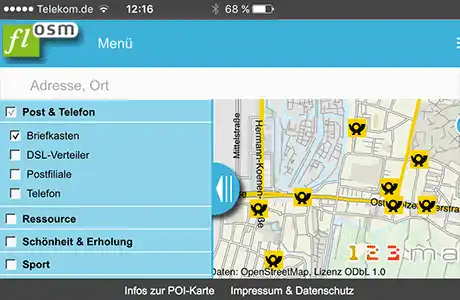
After now almost all modern browsers allow for fast rendering of vectors, we changed flosm.de from Flash to HTML5. Thus, newer mobile devices like phones and tablets able to represent the vector content in high speed.
The maps can now also be accessed on the go and show up important issues from the OSM world. The simple addition of POIs, line and area information can be seen as a special feature of the flosm-maps in general. Thus, each user can create their own sub-themes to cards.
Simple transfer of “own“ maps
With easy imposable informations users can build maps for its own interest by appropriate combinations of the existing switches. The own map compilations are easy to pass and be saved.
By simply copying the URL he summarized features including map detail can be shared and stored.
More informations and examples can be found in the thematic maps. By choosing the Info button in the top left corner further information can easily be accessed.
New features in the thematic maps
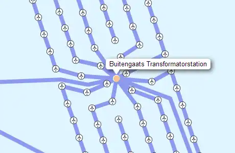
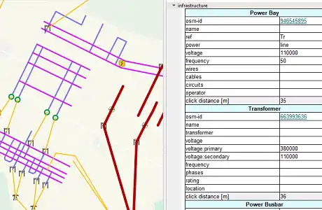
In the POI card some new switches have been added. The current network card is updated and provides advanced details for visualization. The elements in the substations are now considered (converters, switches, compensator, busbar, Bay). The voltage ranges of the power system are now considered completely.
All maps and the switchable information is updated once a week based on the current OpenStreeetMap planet-file with worldwide coverage. All elements of the public transport map are now switched separately.
Additional thematic maps
We are currently working with individual members of the OpenStreetMap project on other thematic maps. Once these work is completed, we will provide the maps here and share it on the OSM-forum/OSM weekly note.